The derecho capped off a very active (for August) 7-day period of severe weather. August 3-4 saw numerous tornadoes associated with the remnants of Hurricane Isaias from North Carolina (where 2 people died in a nighttime EF3 tornado) to Virginia, Maryland, Delaware, Pennsylvania, and New Jersey. Then an EF2 tornado on the evening of August 7 killed two people in southwest Manitoba, Canada.
Monday's derecho started in the early morning hours over South Dakota, crossed Iowa during the morning, and hit Chicago and northern Indiana in the afternoon. Here's an hour by hour composite radar image from NWS Chicago that shows the derecho's rapid progress:
And here's the associated storm reports showing the wide axis of damage across several states, including some embedded "bow echo" or QLCS-type EF0-EF1 tornadoes in the Chicago area:
How does a derecho like this form? Large convective systems are pretty common across the Midwest in summertime. So, what causes one of these systems to become a dangerous and deadly squall line or cluster of storms? Answers have to do with the origin area of the derecho (south-central/southeast South Dakota in this case), as well as the synoptic setting out ahead of it.
Below is the surface map at 5:00 am CDT on 8/10/20, along with a radar inset focused on south-central South Dakota (SD). I've indicated the genesis region of the derecho, where an area of thunderstorms had formed during the early a.m. hours within the thick black oval on the surface map, north of a frontal boundary over Nebraska:
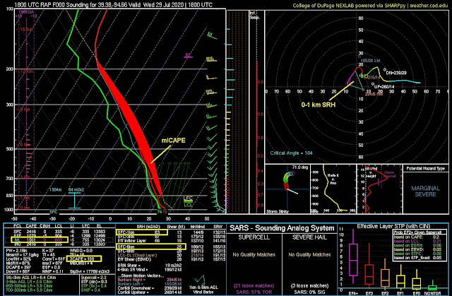
A RAP model forecast sounding at Lake Andes, SD, just east of these thunderstorms, is shown below:
Notice that there was a significant layer of dry air in the lowest 3 km, indicated by the broad distance between the red temperature and blue dew point curves in lower levels. This was _below_ a relatively moist layer beginning at roughly 3 km above ground where significant CAPE was present from a lifted parcel at that elevated level. With little or no convective inhibition (CIN) at this level, elevated storms could initiate well north of the surface front over Nebraska (see 5:00 am surface map earlier), and rain into this dry layer below.
This would produce strong evaporative cooling, creating dense cool air accelerating downward and outward and generating strong surface winds beneath and ahead of the expanding elevated storms over southern SD. Here's a diagram illustrating that process for many summertime derechos that initiate in the northern Plains of the U.S.:
This may look similar to diagrams of downbursts and microbursts, which are much more localized. But what is different and important in Monday's case is that the evaporative cooling and downward air acceleration was taking place over a larger area with the _cluster_ of developing storms, rather than a single thunderstorm. This then spread out into the broad squall line and convective system seen in the composite progressive radar image earlier.
I should emphasize that soundings like the one at Lake Andes up above, with a moist layer of sizable elevated CAPE above a significant layer of dry air (a type of 'overrunning' situation, north of the Nebraska frontal boundary seen on the earlier surface map) are not that common. With a developing thunderstorm cluster, it's a little unusual to see such an elevated moist layer located that far above a depth of much drier air beneath.
Below is the 500 mb NAM model forecast for 4:00 am CDT in the mid-levels of the atmosphere on 8/10/20, showing a significant shortwave disturbance (thick dashed black line) moving across the northern Plains. This disturbance provided the upward forcing that helped fire up the elevated thunderstorms over southern SD that evolved into the derecho:
The inset on the graphic above is a forecast of mlCAPE valid at 7:00 am CDT, showing a long axis of instability extending eastward to Chicago, a corridor that would feed and maintain the convective complex and derecho as it evolved and moved eastward across several states during the morning and afternoon.
A similar situation accompanied a developing derecho that my wife Shawna and I experienced at Pierre SD in the early morning hours of 6/22/15, five years ago. Below is the surface map with the genesis region of the derecho indicated around Pierre at 1:00 AM CDT on 6/22/15:
Here is the RAP model sounding at Pierre SD at about the same time:
Notice that the environment was similar to the 8/10/20 "genesis region" sounding shown earlier, with an elevated moist layer and sizable CAPE located _above_ a dry layer in the lowest 3 km. As new storms formed west of Pierre around midnight, evaporative cooling of rain through this dry layer resulted in the generation of very strong winds (120+ mph measured at Hayes SD!) that caused widespread damage in Pierre (including our motel) and locations eastward on 8/22/15 as the storms morphed into a derecho event.
Many derechos that initiate over the northern Plains and move eastward through the Midwest (the most common area for derechos in the U.S.) probably have this type of atmospheric setting in their genesis region. The drier air in the lowest 2-3 km below an elevated moist layer can result in rapidly-developing strong convective surface winds that spread eastward as a derecho along a west to east corridor of instability.
An important factor is the presence of a stationary or quasi-stationary west-east front (check out the surface maps earlier) with this axis of unstable air along it, helping to provide a corridor along which the recently-intiated derecho can intensify, spread, and maintain itself moving eastward. This was a key feature of Robert John's seminal work on derechos at SPC in the 1980's (see this paper). Johns deserves much credit for making forecasters and meteorologists more aware of these dangerous convective systems.
Derechos are more complicated than this brief analysis would suggest. But I've touched on a few factors that are important for many warm season derechos across the Midwest.
- Jon Davies 8/13/20


