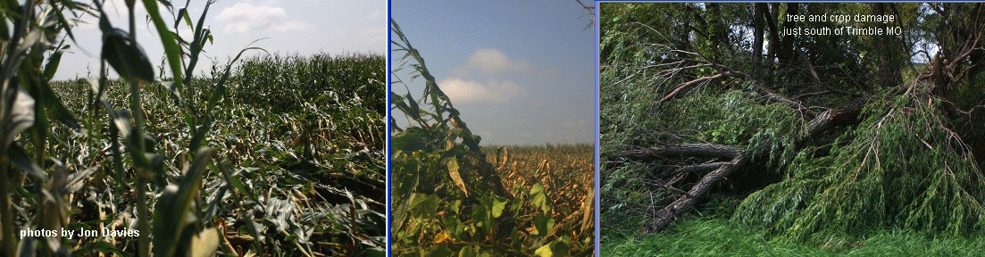


On Friday 8/20/10 while working at home (north of Kansas City), an intense squall line came through and caused an west to east swath of wind damage about two miles south of where I lived. The photos above show sections of corn crops flattened and some tree damage in that swath, damage I wasn't aware of until the next day when my wife Shawna noticed it while driving to Kansas City. There's really nothing unusual about this, except it seems the swath was associated with a forward "notch" in the line on radar, suggestive of a surface circulation with strong winds about 1-2 miles across called a mesovortex. The Kansas City NWS office at Pleasant Hill MO issued a tornado warning (based on this feature) a few minutes after it passed to the south of my house, and wind reports of 70-80 mph winds were verified in Holt MO, about 15 miles to my east. It's not too often a feature like this comes close to your home, so I thought I'd post a little documentation here.
NWS issued severe thunderstorm warnings for Clinton/Platte/Clay counties of MO well before the squall line passed my house. My photos above show views to the south and west as the line approached my home, with a bowing dark cloud shelf to my south and a ragged chaotic cloud base to my west just north of the "notch" on radar (I wasn't aware of the radar feature or damage until later). The forward flank "notch" can be seen on the radar base reflectivity images above (arrows), as well as the low-level base velocity image (circle). It was difficult to pick out a rotational "couplet" with this feature on storm-relative radar velocity images from the Pleasant Hill NWS radar (not shown). However, according to Evan Bookbinder at the NWS office, the closer and more favorably located Terminal Doppler Radar near MCI (KC International Airport, not shown) indicated a pronounced couplet with 80-90 mph winds toward the east on its south side as the feature approached Holt MO, prompting the tornado warning around 1905 UTC. The wind damage south of my home (a swath of 70-80 mph winds) clearly lined up with this radar feature before the tornado warning as it tracked eastward.
A surface map is also shown above, showing the squall line location after 1800 UTC, and surface temps in the 90s F ahead of the line with dew points in the mid-upper 70s F. The early afternoon environment over northwest Missouri (not shown) was quite unstable, with CAPE values near 4000 J/kg, around 30-35 knots of deep layer shear (0-6 km AGL), but little low-level shear (storm-relative helicity less than 80-90 m2/s2). So, the CAPE/shear setting was supportive of strong organized storms (possible supercells) with potential for wind damage, but suggested little support for much in the way of tornadoes. Forward flank squall line circulations in such settings can certainly produce notable wind damage, and even occasional weak/brief tornadoes of non-supercell origin.
- Jon Davies 8/22/10